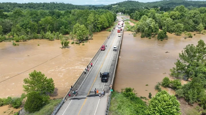
17 Million Under Flood Watch from Texas to Mississippi
Tyunews.com – Heavy rainfall is creating a significant flood risk across a vast region stretching from Texas to Mississippi, with over 17 million Americans under watch as of Tuesday, June 16, 2026. The National Weather Service has issued warnings for potential flash flooding in areas including Corpus Christi, Houston, Lafayette, Alexandria, Louisiana, and McComb, Mississippi. A level 3 out of 4 threat level is active in these zones, indicating a high probability of severe weather impacts.
Meanwhile, the Midwest braces for a severe weather outbreak on Wednesday, with forecasts pointing to destructive conditions in Illinois and Indiana. A level 4 of 5 moderate risk is in effect for central Illinois and northern Indiana, covering cities like Springfield, Peoria, and Decatur, as well as Rensselaer, Indiana. This could bring large tornadoes, wind gusts exceeding 80 mph, and hail the size of baseballs.
Tragic Flash Flood Incident in Texas
A woman in Bandera County, Texas, northwest of San Antonio, reported to 911 on Monday that her vehicle was being carried by floodwaters into a creek. The sheriff’s office shared the details on social media, noting the call disconnected shortly after. Hours later, the woman was discovered dead in the car, several miles downstream from where it initially entered the water.
“A woman in Bandera County called 911 on Monday morning, saying her car was being swept away into a creek by floodwaters,” the sheriff’s office stated. “Within moments, the call dropped, and hours later the woman was found dead in the vehicle several miles downstream from its entry point.”
Stalled vehicles and waterlogged roads have been reported in San Antonio, Houston, and Waco, while Shreveport, Louisiana, experienced water rescues and rising flood levels inside structures. In St. Martin, Mississippi, ramps to I-10 and I-110 were closed due to high water, and Kessler Air Force Base faced impassable roads further south.
Tropical Low Threatens Midwest
The severe weather system affecting the Midwest on Wednesday is linked to a developing tropical low in the western Gulf of Mexico. The National Hurricane Center predicts a 60% chance this system could become a tropical storm by Tuesday or Wednesday, potentially named Arthur as the first of the season. This storm could intensify into a major threat, bringing prolonged heavy rain and localized flooding.
While coastal regions may see less sustained rainfall, the inland areas remain at risk for significant flash flooding. The National Weather Service warns that the greatest danger lies along a frontal boundary affecting central Louisiana and southeast Mississippi, where heavy rains are expected to last several hours. These conditions could lead to widespread flooding and hazardous travel situations.